
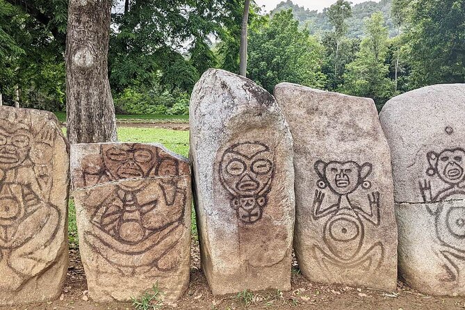
Review · PUERTO RICO
Puerto Rico Unlocked 500+ Hidden Gems and Spots
Puerto Rico rewards curious drivers. This digital map gathers more than 500 places across the island, from quiet beaches and river pools to churches, plazas, food stops, caves, and viewpoints. I like the direct Google Maps links and the sheer range of choices, especially if you want to plan your own days instead of following a guide on a fixed route.
I also like that access lasts for life, with new places added over time. The main catch is simple: this is not a guided tour. You provide the car, fuel, parking, timing, and judgment about road and weather conditions. That freedom is valuable, but it also means you must do some planning yourself.
In This Review
- Key points at a glance
- What you actually buy for $29.99
- How the eight-day plan works
- Day 1: Rio Grande and 87 river locations
- Day 2: Aguadilla and 105 beaches
- Day 3: Lares and 21 scenic viewpoints
- Day 4: Aguada and Puerto Rico’s historic places
- Day 5: Luquillo and nine food stops
- Day 6: Ponce and the unusual 50-plus places
- Day 7: Toa Alta and more than 50 town plazas
- Day 8: Carolina and 87-plus sacred sites
- Navigation, timing, and the meeting point
- What the strong feedback tells you
- Who should buy it?
- Should you book Puerto Rico Unlocked?
- FAQ
- Is this a guided tour?
- How many locations are included?
- How much does the map cost?
- How long can I use the map?
- Do the locations open in Google Maps?
- Do I need a rental car?
- Are entrance fees included?
- Are meals and drinks included?
- Is equipment provided for rivers or caves?
- What should I know before visiting rivers?
Key points at a glance
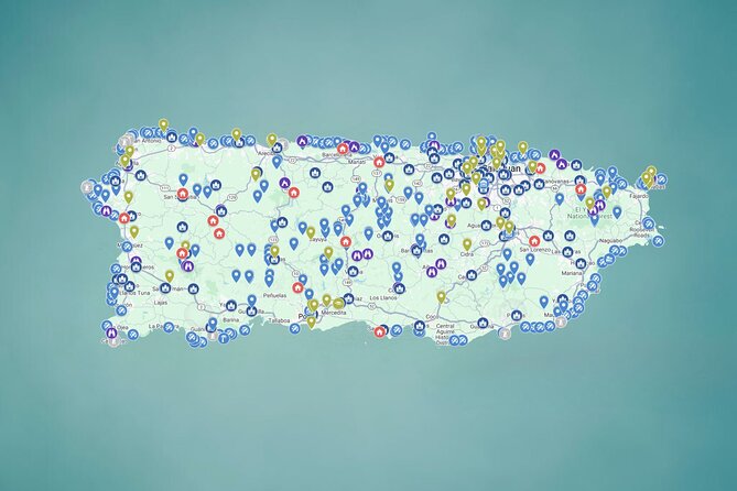
- 500+ locations across Puerto Rico: Beaches, rivers, waterfalls, caves, viewpoints, churches, plazas, historic sites, and food stops are grouped by type.
- One-click navigation: Tap a location on your phone and open it in Google Maps for directions.
- Eight suggested exploration days: Each day points you toward a different area and theme, with about four hours of activity suggested.
- Lifetime digital access: You can keep using the map after your trip, including future updates and added locations.
- Strong value for groups: At $29.99 per group of up to 15, the price can be modest when split among friends or family.
- Safety matters at rivers: Avoid river visits after rain or when rain is forecast. Water levels can rise quickly, and currents can become dangerous.
What you actually buy for $29.99
This is best understood as a planning tool, not a conventional excursion. You receive a mobile-friendly Google Map with more than 500 marked locations. Each pin can include photos, practical notes, and links, then send you directly to Google Maps for navigation.
That saves the most valuable thing on vacation: time. Puerto Rico has no shortage of information online, but scattered pages, old posts, and repeated suggestions can make route planning slow. The map places many options in one system, so you can look at an area and decide what fits your day.
I see the price as especially good for a group. The stated rate is $29.99 for up to 15 people, so a family or group of friends may pay only a few dollars each. Even if you use it for one full day, the saved planning time can justify the cost. If you visit several times or return to Puerto Rico, the lifetime access makes the deal stronger.
The map does not cover the rest of your expenses. You still pay for the rental car, gasoline, tolls, parking, meals, drinks, equipment, and any entrance charges. Most locations are free, but not all of them are. If you are hoping for transport or a guide, this product will not meet that need.
Other trips worth a look in Puerto Rico:
- San Juan Guided Snorkel With Turtles Tour and Videos
★ 5.0 · 12,947 reviews - Top Rated El Yunque Rainforest & Waterslide – SmallGroup Tour
★ 5.0 · 12,789 reviews - Half-Day Yunque Rainforest Waterslide & rope swing Guided Tour
★ 5.0 · 6,534 reviews
How the eight-day plan works
The suggested schedule gives you a useful starting framework. Each day lists one broad area and roughly four hours of exploring. You do not have to follow the schedule in order, and you should not treat the four-hour estimate as a promise. Driving times, weather, road conditions, and how long you stay at each place will change the pace.
The plan works best as a menu. Pick a region near where you are staying, select a few pins, and leave room for food, parking, and unplanned stops. Trying to cross the island repeatedly just to check off locations would turn a relaxed tool into a very busy road trip.
Day 1: Rio Grande and 87 river locations
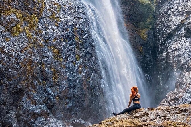
The first suggested day focuses on rivers around Rio Grande, with 87 places ranging from waterfalls and natural pools to quieter jungle spots. This is one of the most appealing parts of the map for people who want more than a beach afternoon.
You might find a shaded pool for a slow day, a waterfall area for photos, or a place suited to a more active outing. The notes and location links can help you compare options before leaving, which is useful when you need to judge distance and conditions.
Here, safety is not a footnote. You should check the weather carefully and choose a day with completely sunny conditions and no rain in the area. A river can look calm while still becoming dangerous after rainfall upstream. Strong currents and rising water can develop quickly, so skip the river plan when skies are cloudy or rain is expected.
Bring only equipment you already know how to use. Life jackets, helmets, and other gear are not supplied. The map can point you toward a river, but it cannot replace local safety advice or sound judgment.
Day 2: Aguadilla and 105 beaches
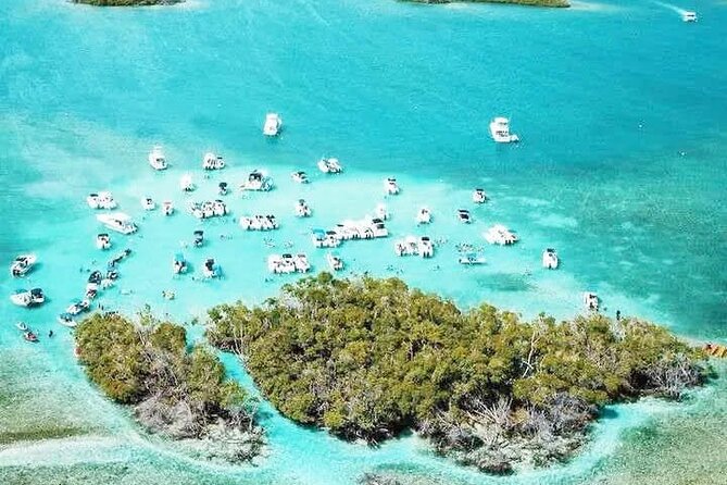
Aguadilla is the suggested base for a day built around 105 beaches. That number gives you flexibility. You can look for a quieter shore, choose a family-friendly place, or add a beach near roadside food stalls and other conveniences.
This category may be the most useful for a group with mixed interests. One person may want a peaceful place, another may prefer an easy swim, and someone else may care most about a nearby meal. Instead of committing to one famous beach, you can compare several possibilities on the map.
The drawback is choice overload. One hundred and five pins are exciting when planning, but not practical to visit in a single day. Pick two or three at most, then check the map notes and navigation times before setting out. A beach may look close on the island map yet take longer to reach because of winding roads or local traffic.
Use the map to build a sensible route rather than chasing every attractive photograph. The best day will probably include time to sit still.
A completely different kind of day:
- El Yunque Rainforest Waterslides and Luquillo Beach w/ Transport
★ 4.5 · 5,098 reviews - Night Kayak – Condado City Lights Tour
★ 4.5 · 4,807 reviews - Luquillo Beach Horse Ride from Carabalí Rainforest Adventure Park
★ 5.0 · 4,762 reviews - Authentic Flavors of San Juan Food Tour
★ 5.0 · 4,741 reviews
Day 3: Lares and 21 scenic viewpoints
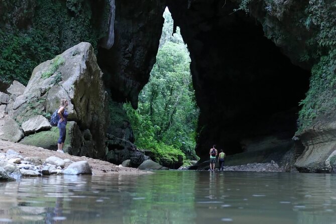
The Lares day features 21 viewpoints, including mountain overlooks and places with broad views toward the Caribbean. This section gives the map a slower, more reflective side. You are not simply moving between swimming holes and beaches. You are also seeing how much the island changes away from the coast.
Viewpoints are easy to add to a road trip. A stop may take only a short time, or it may become a longer pause if the view and conditions are good. I would use these locations to break up a driving day and to connect inland towns with coastal plans.
Do not assume every viewpoint offers the same level of comfort. The supplied information does not promise facilities, seating, or easy access at every pin. Read the notes, watch your route, and allow extra time if you have a moderate fitness level but do not want a demanding outing.
Day 4: Aguada and Puerto Rico’s historic places
The Aguada day turns from nature to culture. The map gathers forts, churches, colonial buildings, and secret tunnels, creating a route through places shaped by battles, faith, and island life.
This category is valuable because it gives context to a trip that might otherwise become a string of scenic stops. A church or old building may not take long to visit, but it can change your understanding of the town around it. The suggested locations also give you a reason to slow down and walk rather than spend the whole day behind the wheel.
Access details may vary. Some sites can charge admission, and the map does not include entrance fees. You should also check whether a place is open before making it the main purpose of your day. The digital map provides starting information, but it is not a guarantee of current hours.
Day 5: Luquillo and nine food stops
The Luquillo day is the shortest category, with nine food locations. That is not a weakness. Food planning works better when you have a focused list rather than an endless catalogue.
The choices include alcapurrias, mofongo, lechón, and tropical juices. These are the kinds of stops that can turn a drive into a taste of Puerto Rican daily life. You can use the map to plan one main meal and a couple of smaller stops, or simply keep the pins ready when hunger appears.
Food hours and availability can change, so check current information before driving far for one dish. Meals and drinks are not included in the purchase price. I would also avoid building a schedule so tight that you cannot stop when a local place looks promising. A map should help you eat better, not make lunch feel like an appointment.
Day 6: Ponce and the unusual 50-plus places
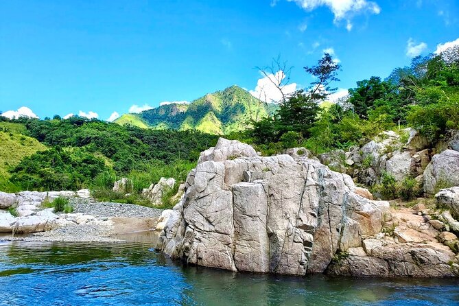
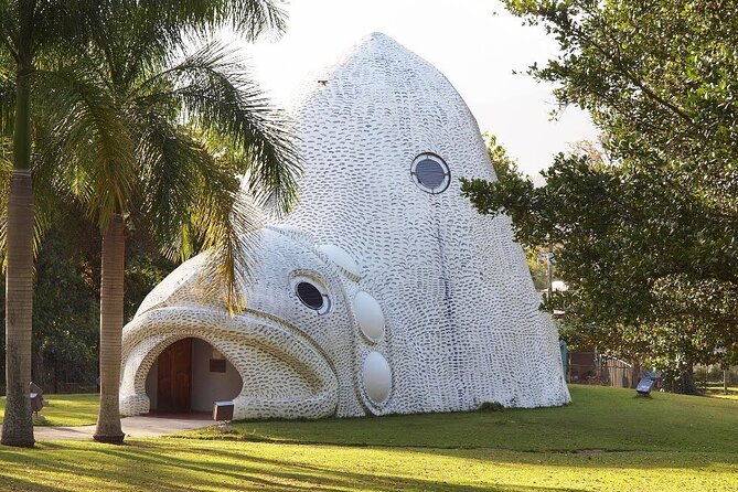
Ponce gets the category for places that do not fit neatly elsewhere. More than 50 locations include unusual tunnels, rock formations, waterfalls, large sculptures, stairways, and other out-of-the-ordinary stops.
This may be the most fun section for repeat visitors or anyone who has already seen the standard highlights. It encourages curiosity and gives you alternatives when you want something less predictable. The descriptions suggest a mix of natural features, art, and odd corners of the island.
The tradeoff is that unusual locations can require more care. The information provided does not promise that every site is easy to reach or suitable for every fitness level. If you plan a waterfall, tunnel, or rocky stop, check the notes, weather, footwear, and access conditions first. A striking photograph is not worth a reckless climb.
Day 7: Toa Alta and more than 50 town plazas
The Toa Alta day focuses on more than 50 plazas. These town squares are not merely points to photograph. They are places where music, children, pigeons, trees, and everyday conversation can bring a town to life.
I like this category because it may be the easiest way to find a more ordinary side of Puerto Rico. A plaza stop costs nothing in many cases, needs little time, and can fit between larger attractions. You can sit, walk, look at the surrounding buildings, or use the square as a break during a driving day.
The map does not provide a fixed cultural program, so you should not expect music or events every time. Its value is in directing you toward town centers where local life happens. Pair a plaza with a nearby church or food stop and you have the makings of a pleasant half-day.
Day 8: Carolina and 87-plus sacred sites
The final suggested day turns to churches and other sacred places, with more than 87 sites ranging from major cathedrals to small hilltop chapels. This is a strong option for anyone interested in architecture, religious life, or quiet places with a sense of time.
You do not need to be religious to appreciate this part of the map. Churches can show local building styles, community traditions, and the importance of faith in Puerto Rican towns. Some locations may be simple from the outside, while others may offer a striking interior or setting.
Please be respectful. Dress and behavior expectations can differ, and an active church is a place of worship, not just a sightseeing stop. The map does not promise that every building will be open during your visit, so confirm access when possible.
Navigation, timing, and the meeting point
The map is available by mobile ticket, and the operating window is listed as 24 hours a day from September 27, 2024, through December 28, 2026. That means you can use it when it suits your schedule, not only during a scheduled departure.
A listed starting point is Plaza Colón at FV8Q+C57, C. de la Fortaleza, San Juan. The listed ending point is the same meeting point. Since this is a self-guided digital product with no transport or guide service, do not interpret that as a group departure location. You are using the map independently.
The suggested plan allows about four hours per day, but the full experience is described as approximately eight days. In practice, you can use it for a weekend, a long stay, or several future visits. You will need a rental car, a charged phone, mobile data or saved directions, and enough time to handle parking and fuel.
There is also a small inconsistency in the supplied capacity details. The price covers a group of up to 15, while the general activity information gives a maximum of 30 people. For a normal purchase, rely on the stated group limit of 15 and confirm larger arrangements before paying.
What the strong feedback tells you
The most praised feature is ease of use. People who used the map liked that locations opened directly in Google Maps and that they could stop searching through scattered blogs and social media posts.
Another repeated strength is range. The map helped with beaches, rivers, caves, museums, historic places, churches, and food. That broad mix matters because it lets you shape the trip around your interests instead of following one narrow theme.
The strongest personal benefit is freedom. You can change plans, choose your pace, and find a calm river one day and a historic church the next. One especially useful point is that the map is not only for photographs. It can help you experience quiet places and local stories, not just collect scenic stops.
One caution is that enthusiastic feedback includes a claim from someone who has lived in Puerto Rico and felt the map revealed places they had not seen. That is encouraging, but you should still treat every pin as a suggestion, not a guarantee. Conditions, access, weather, and opening hours can change.
Who should buy it?
I would recommend this map to independent drivers who enjoy choosing their own stops. It suits families, couples, groups of friends, solo visitors, and repeat visitors who want more options than the usual San Juan, El Yunque, and beach circuit.
It is also a good match for a long stay. You can use the most convenient locations first and save the rest for another day. The lifetime access means the purchase does not have to be consumed during one holiday.
I would not choose it if you need a guide, transportation, a tightly organized schedule, or someone else to handle safety decisions. It is also a poor fit if you plan to stay in one small area and do not want to rent a car.
Should you book Puerto Rico Unlocked?
At $29.99 per group, I think this is a strong buy for a self-guided Puerto Rico road trip. The one-click directions, large range of places, and lifetime updates address the hardest part of island travel: deciding where to go next.
Book it if you value freedom and want a ready-made starting point for beaches, rivers, viewpoints, food, history, plazas, and churches. Skip it if you want a traditional tour with a guide and included transport. Above all, use the river information seriously, check the weather, and give yourself permission to visit only a few places well.
The purchase is non-refundable and cannot be changed after booking, so make sure the self-guided format suits you before paying.
FAQ
Is this a guided tour?
No. It is a self-guided digital Google Map. Transportation and guide service are not included.
How many locations are included?
The map includes more than 500 locations across Puerto Rico.
How much does the map cost?
The listed price is $29.99 per group of up to 15 people.
How long can I use the map?
You receive lifetime access, including updates and new locations added over time.
Do the locations open in Google Maps?
Yes. The pins are clickable and open directly in Google Maps for GPS navigation.
Do I need a rental car?
Yes. Transportation is not included, and the experience is designed for self-driving exploration.
Are entrance fees included?
No. Most places are free, but some sites or parking areas may charge.
Are meals and drinks included?
No. Meals, drinks, and personal expenses are not included.
Is equipment provided for rivers or caves?
No. Equipment such as helmets and life jackets is not provided.
What should I know before visiting rivers?
Check the weather first and visit only when the area is completely sunny with no rain forecast. Rivers can rise quickly and develop strong currents after rain.
Just added in Puerto Rico
- Clear Bottom Kayaking and Snorkel Reef Exploration★ 5.0 · 1 review
- CLEAR BOTTOM KAYAKS Tour in Bioluminescent, Mosquito Bay★ 4.0 · 30 reviews
- Full Clear Kayak Bioluminescent Experience Vieques, Puerto Rico★ 5.0 · 1 review
- Isla de Vieques Beach Hopper Sightseeing Tour★ 3.0 · 2 reviews
- eFoil Lesson Old San Juan★ 5.0 · 5 reviews
- Private Tour of the White Canyon Ancestral Route in Utuado★ 5.0 · 7 reviews
- El Yunque Rainforest Party Tour with Waterslide and Rope Swinging★ 5.0 · 1 review
- Yoga and Sound Healing at the Beach!★ 5.0 · 1 review