

Review · SELF-GUIDED TOURS
Puerto Rico West Coast Self Guided Tour
The west is where Puerto Rico opens up. This low-cost digital map points you toward waterfalls, dry forest trails, cliff-top views, quiet beaches, surf towns, and coastal waters that are easy to miss when you stick to the main routes. I like the Google Maps links, which cut down on time spent hunting through scattered websites, and I like the freedom to shape each day around your own pace. The main tradeoff is that this is only a map and PDF, not transportation or a guided outing, so you must drive, plan, and judge local conditions yourself.
The $5 price is hard to argue with, especially since it covers one group of up to 12 people and gives lifetime access to the English digital map. Still, the information needs careful checking on the ground. One location for a forest trail was reportedly incorrect, and the walk to some spots may be longer than expected. That makes this a useful planning tool, but not a substitute for common sense, weather checks, or a little flexibility.
In This Review
- Five things to know before setting out
- What this $5 map actually gives you
- Day one: Gozalandia Falls, Guanica, and a cave-filled forest
- San Sebastian waterfall stop
- Guanica dry forest
- San Sebastian forest trail and caves
- Day two: San German’s old church and Cabo Rojo’s cliffs
- San German’s historic stone church
- Cabo Rojo cliffs and lighthouse
- Day three: quiet sand, surf, and Lajas after dark
- Rincon’s quiet beach
- Cabo Rojo’s long beach and seafood
- Rincon surf town and sunset
- Isabela’s energetic beach
- Lajas and the glowing night
- How much driving and planning should you expect?
- Who will get the most from this experience?
- Is the Puerto Rico West Coast Self-Guided Tour worth $5?
- FAQ
- How much does the experience cost?
- How long does the self-guided tour take?
- Is this a guided tour?
- What is included?
- Do I need a rental car?
- Are entrance fees included?
- What should I bring for cave or river visits?
- Is the tour suitable for everyone?
- What are the river safety rules?
Five things to know before setting out
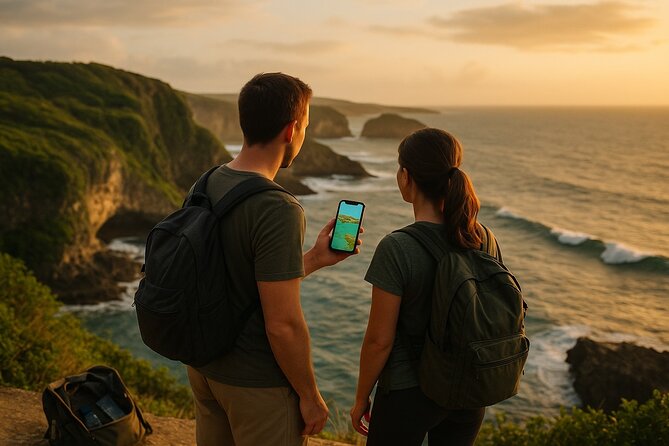
- Ten western Puerto Rico stops: The route includes five beaches and five nature-focused places, from Gozalandia Falls and cave trails to Cabo Rojo’s lighthouse and the waters around Lajas.
- Three flexible days: The suggested plan spreads the stops across San Sebastian, Guanica, San German, Cabo Rojo, Rincon, Isabela, and Lajas.
- One inexpensive digital purchase: The map costs $5 per group of up to 12, with instant and lifetime access.
- A rental car is essential: Transportation, fuel, tolls, parking, and guide service are not included.
- River safety matters: Visit river areas only after checking the forecast and confirming sunny conditions, since water levels can rise quickly after rain.
- Expect some walking: A moderate level of fitness is recommended, and certain routes may involve rocky paths, caves, or longer walks than the brief descriptions suggest.
What this $5 map actually gives you
This experience is best understood as a compact road-trip aid, not a traditional tour. You receive a downloadable PDF in English with photographs, preparation tips, local recommendations, and direct links to Google Maps. Tap a link, follow the route, and decide how long you want to stay.
That simplicity is the appeal. Planning a western Puerto Rico trip can involve piecing together beach names, trail access, parking information, and map pins from many sources. Here, the main job is already done for you. At $5 per group, the cost is tiny compared with a paid excursion.
The map does not cover the costs that can add up during a driving day. You pay for your own rental car, gasoline, tolls, parking, meals, drinks, insurance, and any entrance fees. Most stops are described as free, but some parking areas or sites may charge.
The map is intended for a small group of up to 12 people, while the activity information also gives a maximum of 30 travelers. Since no guide or shared transportation is provided, you should think of this as a private self-drive plan rather than a group tour.
More self-guided walks in Puerto Rico:
- San Juan Self-Guided Walking Audio Tour
★ 4.5 · 44 reviews - Talking Buildings of Old San Juan: A Self-Guided Audio Tour
★ 3.5 · 18 reviews - The Ultimate Self-Guided Hidden Gems Tour in Puerto Rico
★ 5.0 · 13 reviews
Day one: Gozalandia Falls, Guanica, and a cave-filled forest
The first day mixes water, dry forest, and mountain trails. It is the most nature-heavy part of the plan, and it asks you to be alert about weather and road timing.
San Sebastian waterfall stop
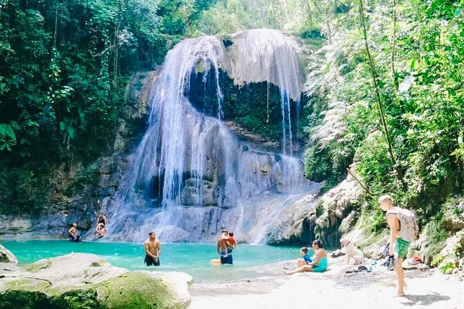
Near San Sebastian, a short walk leads toward a powerful waterfall hidden among green mountain scenery. The description emphasizes the sound of rushing water arriving before the falls come into view, followed by a clear pool and a strong sense of being away from town.
This is the stop commonly known as Gozalandia Falls, and it is one of the most appealing entries on the map. The waterfall is free according to the provided details, though you should still check current local conditions before setting out. Four hours is the suggested duration, which gives you room for walking, photos, and time near the water.
Do not treat a river visit as a casual stop after a rainy morning. The safety advice is direct: check the forecast, look for fully sunny conditions, and avoid the river if rain is possible. Water can rise fast, and currents can become dangerous even when the weather at your starting point looks fine.
Guanica dry forest
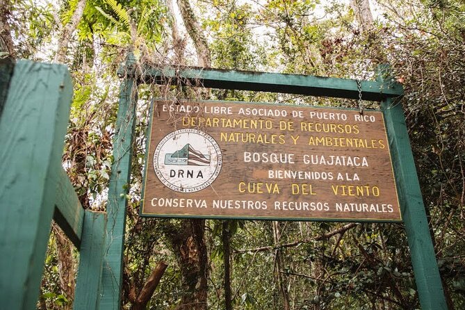
Guanica offers a sharp change from the wet mountain waterfall. This is a dry forest with twisted trees, unusual plant life, ocean viewpoints, trails, and cave areas. It gives you a chance to see a side of Puerto Rico that beach-focused itineraries often skip.
The appeal here is variety rather than one single sight. You might spend part of the visit on an easy trail, stop at a viewpoint, and then look for caves or other natural features. The description presents the area as suitable for learning about rare biodiversity, so it works well for anyone who enjoys scenery with a bit of natural context.
The four-hour suggestion may feel generous for a short trail or brief viewpoint visit, but it gives you breathing room. Bring sensible footwear and water, and remember that the forest setting can feel very different from the coast. The map does not provide equipment, so anything needed for cave or river exploration is your responsibility.
A few more options to weigh up in Puerto Rico
- San Juan Guided Snorkel With Turtles Tour and Videos
★ 5.0 · 12,947 reviews - Half-Day Yunque Rainforest Waterslide & rope swing Guided Tour
★ 5.0 · 6,534 reviews - Epic Guided Adventure in El Yunque National Rainforest & Beach
★ 4.5 · 456 reviews - El Yunque Rainforest Guided Day Tour from San Juan
★ 5.0 · 452 reviews
San Sebastian forest trail and caves
The second San Sebastian nature stop adds quiet trails, dry vegetation, caves, and overlooks. It sounds less like a single famous attraction and more like a slow walk through the western mountains.
That can be a strength. You are not simply checking off a viewpoint. You have time to walk, pause, and look for the natural features described in the map. It is a good match for solo visitors and couples who prefer a peaceful outing over a packed attraction.
There is also an important caution here. A location pin for this forest was reported to be wrong, and the correct place was reached by following information from other people on the road. Before leaving, compare the PDF details with the Google Maps link and confirm that the route makes sense. This is the clearest reason to treat the map as a helpful guide rather than perfect navigation.
Day two: San German’s old church and Cabo Rojo’s cliffs
The second day shifts toward architecture and the southwest coast. It gives you a useful break from trails while keeping the outdoor feel.
San German’s historic stone church
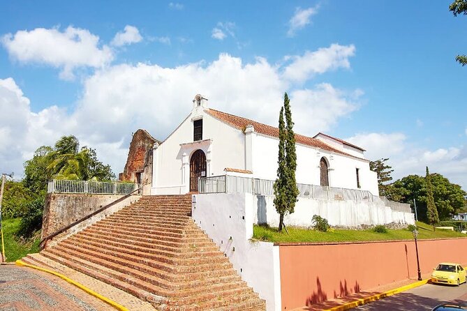
San German is one of Puerto Rico’s oldest towns, and the featured stop is a stone church on a hill. It was originally built in 1609 and is described as one of the oldest temples in the Western Hemisphere.
This is a worthwhile pause for anyone who wants more than beaches. The building gives you a direct connection to the island’s colonial past, while the hilltop setting adds a visual reward. You can spend time looking at the structure, taking photos, and walking around the surrounding area.
The information does not list an entrance fee, so the stop is presented as free. Still, opening conditions can change, and the listed tour hours of 7:00 a.m. to 6:00 p.m. refer to the activity’s operating window, not necessarily every individual site. Plan the church visit during daylight rather than assuming every interior space will be open.
Cabo Rojo cliffs and lighthouse
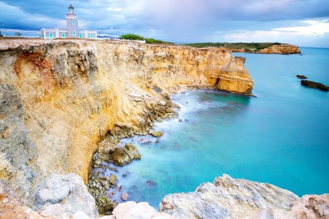
The Cabo Rojo stop is one of the strongest photo opportunities in the plan. You walk along limestone cliffs, pass salt flats and rocky paths, and reach a historic lighthouse watching over the sea.
The lighthouse received especially strong praise for its views, photographs, and walking route. That praise is easy to understand from the description. You get open coastal scenery, a landmark with character, and a walk that feels more rewarding than simply pulling over for a quick picture.
Allow the full four-hour suggestion if you want to walk at an easy pace and take in the salt flats as well as the lighthouse. Rocky ground can slow you down, and the exact walking distance may be greater than you expect. Good shoes matter here.
Cabo Rojo also appears again on day three for a long beach and seafood stop. That is not wasted repetition. The southwest coast offers two very different experiences: cliffs and wind on one visit, calm water and food on another.
Day three: quiet sand, surf, and Lajas after dark
The final day is the most beach-focused. It moves from Rincon to Cabo Rojo, back toward the northwest, and then south to Lajas. Because five stops are listed, you need to be realistic about timing. Four hours per stop would make this far longer than a normal day, so use the schedule as a menu of options rather than a promise to complete every stop comfortably.
Rincon’s quiet beach
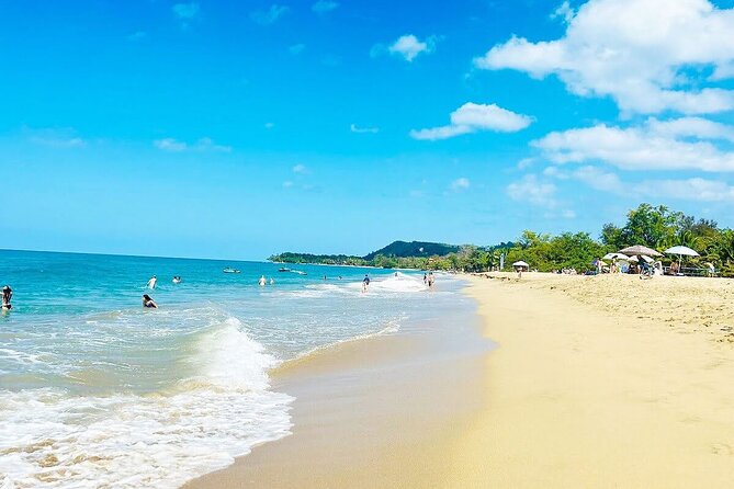
The first Rincon stop is a small, calm beach surrounded by greenery. It is meant for slowing down: sunbathing, reading, or spending quiet time beside gentle waves.
This is a useful counterpoint to the better-known surf beaches nearby. If you want a peaceful morning instead of boards and strong swells, this stop fits the bill. The map does not provide a specific beach name in the supplied details, so use the linked location rather than guessing from general Rincon beach lists.
Cabo Rojo’s long beach and seafood
The second Cabo Rojo stop is a long, peaceful beach with calm water, local restaurants, and fresh seafood. It is the least complicated kind of beach day: stroll, sit by the shore, then eat nearby.
The food component makes this stop especially practical. You do not need to treat it as a short photo stop. Build in time for a relaxed meal and enjoy the coastal setting without rushing to the next attraction.
Rincon surf town and sunset
Another Rincon stop focuses on the area’s famous surf culture. The waves are consistent, mornings are described as golden, and surf schools are close to the beach. Oceanfront lodging and a relaxed beach atmosphere add to the appeal.
You do not need to surf to enjoy this part of the itinerary. Watching lessons, walking near the water, or timing your visit for sunset can work just as well. If you do want to take a lesson, the map points you toward the right type of area, but it does not include instruction or equipment.
Isabela’s energetic beach
Isabela offers a mix of surf and calmer sections of shore. Surfers come for serious waves, while other visitors can find room to relax. Nearby kiosks and music add a more social feel than the quiet Rincon beach.
This is a good place to choose according to your mood. Strong surf gives the coast energy, while calmer patches make it possible to enjoy the setting without getting in the water. As always, conditions matter, and you should use local judgment before swimming.
Lajas and the glowing night
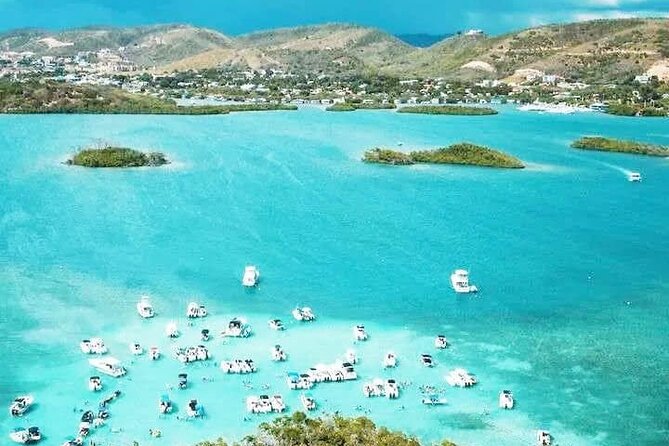
The Lajas stop rounds out the trip with boat rides through mangrove cays, turquoise water, swimming, floating docks, and a glowing nighttime experience. This is the most unusual water outing in the plan, and it may become the highlight for visitors who enjoy being on the water.
The map does not include boat transport, meals, or equipment rental, so check what you need before leaving. The description presents the night as a special part of the experience, but you should plan the timing carefully if you are also trying to visit Rincon, Isabela, and Cabo Rojo on the same day.
How much driving and planning should you expect?
This is a self-drive trip beginning at GX2G+HM4, 87 Calle Manuel Corchado Juarbe in Isabela. The stated end point is the same meeting point, so you are responsible for returning there after the route.
The three-day outline covers a large portion of western Puerto Rico. San Sebastian and Guanica are inland or southwest-facing nature stops, while San German, Cabo Rojo, Rincon, Isabela, and Lajas spread across the western and southern coast. The route is not a single compact walking tour.
I would use the PDF to select two or three priorities per day, then keep the other stops as backups. This is especially important on day three, where five stops compete for your time. Google Maps links help with navigation, but they cannot solve road delays, parking difficulty, weather, or a wrong pin.
Who will get the most from this experience?
I think the map is best for couples, families, and solo visitors who already plan to rent a car. It suits people who want flexibility and do not want to spend an evening sorting through dozens of separate beach and trail pages.
It is also a good fit if you enjoy mixing activities. You can combine a waterfall, a dry forest, a historic church, a lighthouse, beaches, surf culture, and nighttime water scenery in one broad trip.
It is less suitable if you want a guide, included transport, organized timing, or hands-on support at caves and rivers. You also need a moderate fitness level, since several stops include hiking, rocky paths, cliffs, or longer walks.
The cancellation terms are strict: the $5 payment is non-refundable and cannot be changed. Because the price is small, the financial risk is limited, but you should still check your dates before buying.
Is the Puerto Rico West Coast Self-Guided Tour worth $5?
Yes, if you already have a car and want a fast way to organize western Puerto Rico. The combination of ten selected stops, photographs, local tips, and clickable map links gives the price real value.
I would not buy it expecting a polished tour operation. You receive no guide, transportation, gear, meals, or guaranteed site access. The incorrect forest location is a useful warning that you should verify directions before driving.
Book it if you value freedom and variety, especially if Gozalandia Falls, Cabo Rojo’s lighthouse, Rincon’s beaches, and Lajas appeal to you. Skip it if you need a tightly managed itinerary. For independent drivers, it is a remarkably inexpensive starting point, provided you leave room for weather and map corrections.
FAQ
How much does the experience cost?
The price is $5 per group of up to 12 people.
How long does the self-guided tour take?
The suggested duration is approximately three days.
Is this a guided tour?
No. It is a self-guided digital map and PDF. A guide and transportation are not included.
What is included?
You receive access to ten west coast locations, an English PDF, photographs, local tips, exclusive recommendations, lifetime access, and clickable Google Maps navigation links.
Do I need a rental car?
Yes. The experience is self-drive, and transportation is not included.
Are entrance fees included?
No. Most locations are free, but some sites or parking areas may charge.
What should I bring for cave or river visits?
Equipment such as helmets and life jackets is not provided. You are responsible for arranging any equipment needed.
Is the tour suitable for everyone?
A moderate level of physical fitness is recommended. Some stops include trails, caves, rocky paths, cliffs, or longer walks.
What are the river safety rules?
Check the weather before visiting a river and go only when the area is fully sunny with no chance of rain. Avoid river visits on cloudy days or when rain is forecast, since water levels and currents can change quickly.
Just added in Puerto Rico
- Clear Bottom Kayaking and Snorkel Reef Exploration★ 5.0 · 1 review
- CLEAR BOTTOM KAYAKS Tour in Bioluminescent, Mosquito Bay★ 4.0 · 30 reviews
- Full Clear Kayak Bioluminescent Experience Vieques, Puerto Rico★ 5.0 · 1 review
- Isla de Vieques Beach Hopper Sightseeing Tour★ 3.0 · 2 reviews
- eFoil Lesson Old San Juan★ 5.0 · 5 reviews
- Private Tour of the White Canyon Ancestral Route in Utuado★ 5.0 · 7 reviews
- El Yunque Rainforest Party Tour with Waterslide and Rope Swinging★ 5.0 · 1 review
- Yoga and Sound Healing at the Beach!★ 5.0 · 1 review
Self-Guided Tours, compared.

Talking Buildings of Old San Juan: A Self-Guided Audio Tour
Read our review →
The Ultimate Self-Guided Hidden Gems Tour in Puerto Rico
Read our review →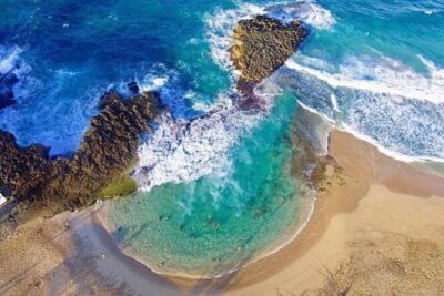
Secret Spots in North Puerto Rico: Self Guided Tour
Read our review →
Browse the lists this tour appears in