
Review · SELF-GUIDED TOURS
Secret Spots in North Puerto Rico: Self Guided Tour
Skip the usual Puerto Rico checklist. This $5 self-guided map points you toward caves, coastal pools, old plantation grounds, beaches, petroglyphs, and other places scattered across the island’s north coast. I like the low group price and the simple format: you receive an English PDF with photos, local preparation tips, and one-click links to Google Maps. The main catch is that you must drive yourself, plan your own days, and check conditions carefully before visiting rivers or ocean pools.
I also like the freedom. You are not tied to a guide, bus schedule, or fixed lunch stop. One location can take an hour, while another may fill half a day. The tradeoff is that the map gives you destinations rather than a full touring service, so you handle fuel, tolls, parking, meals, equipment, safety checks, and any entrance charges.
In This Review
- Key points at a glance
- What the $5 map really gives you
- Day one: Camuy and the island beneath your feet
- Day two: rum, plantation grounds, and a shopping stop
- Day three: sea caves, petroglyphs, and calm water
- How to plan the three days without rushing
- Safety, weather, and what to carry
- Who gets the most from this self-guided format
- Is this $5 Puerto Rico map worth buying?
- FAQ
- How much does the self-guided tour cost?
- How long does the experience take?
- Is transportation included?
- What does the digital map include?
- Are entrance fees included?
- Are fuel, tolls, and parking included?
- Is equipment provided for cave or river visits?
- What should you know before visiting rivers?
- Where does the activity start and end?
Key points at a glance
- Only $5 per group: The price covers up to 12 people, making it unusually inexpensive for couples, families, or a small group sharing one rental car.
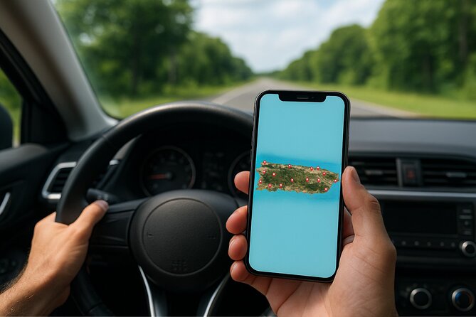
- One-click navigation: Each location includes a direct Google Maps link, which makes the PDF practical even if you are not comfortable with travel apps.
- A strong mix of nature and culture: Caves, coves, rock pools, petroglyphs, a rum facility, a plantation, and an outlet center give you more variety than a beach-only day.
- Three flexible days: The plan includes Camuy, Cataño, Manatí, Barceloneta, and Arecibo, but you choose the order and how long to stay.
- Safety matters at water sites: Avoid river visits after rain or under cloudy conditions, since water levels and currents can change quickly.
- Bring your own transport and gear: This is a digital product, not a chauffeured outing. Rental-car costs, parking, fuel, tolls, food, insurance, and equipment are separate.
What the $5 map really gives you
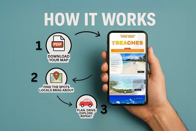
The value here is not a guided explanation at each stop. It is the time saved before you leave your hotel or rental apartment. The PDF gathers photos, short preparation notes, and direct directions in one place, so you do not have to build a north coast route from scattered web pages.
That matters in Puerto Rico, where a day can easily get eaten by driving, searching for a turnoff, or trying to decide which beach or cave is worth the effort. The map gives you a ready-made list, but it still leaves room for common sense. You can skip a site if the weather turns, stay longer at a cove, or replace shopping with another natural stop.
The strongest feature is the Google Maps connection. One tap opens directions, and no extra app is required beyond Google Maps itself. If you are not especially comfortable with technology, this is reassuring. Save the PDF to your phone before setting out, since a downloaded file is easier to use than trying to find the original booking page on the road.
The price is per group, not per person, for up to 12 people. That is excellent value if you already have a rental car and several people are sharing the cost. It is less of a complete bargain if you need to pay for a car, fuel, tolls, parking, meals, entrance fees, and rental equipment on top. Still, the map itself costs less than many single paid attractions.
More self-guided walks in Puerto Rico:
- San Juan Self-Guided Walking Audio Tour
★ 4.5 · 44 reviews - Talking Buildings of Old San Juan: A Self-Guided Audio Tour
★ 3.5 · 18 reviews - The Ultimate Self-Guided Hidden Gems Tour in Puerto Rico
★ 5.0 · 13 reviews
Day one: Camuy and the island beneath your feet
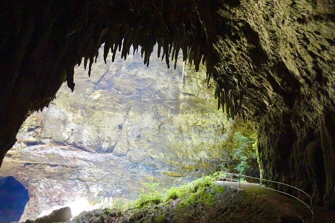
The first listed stop is Camuy, home to a huge cave system shaped by the Camuy River over millions of years. The suggested visit lasts about four hours, which tells you this is not a quick roadside photo stop. Plan for time spent walking through large underground chambers and taking in the quiet, enclosed setting.
I like this opening because it gives your trip a clear sense of place. Puerto Rico is often reduced to beaches and cocktails, but Camuy shows the force of water and time below the surface. The cave setting also provides a useful change of pace if your first day on the north coast is hot and sunny.
The itinerary marks admission as free, but the general conditions say entrance fees are not included and that some places or parking areas may charge. Check the current situation before setting out. You should also pay attention to the moderate fitness recommendation. The map does not promise a completely easy walk, and cave visits may involve uneven ground or physical effort.
Equipment is not supplied. For any cave or river activity, you are responsible for arranging items such as helmets or life jackets if they are needed. The digital guide gives you the destination and practical tips, but it does not replace on-site safety rules or staff instructions.
Day two: rum, plantation grounds, and a shopping stop
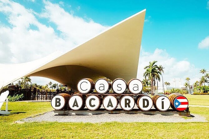
Day two shifts from underground scenery to a broader mix of culture, history, nature, and retail. It begins in Cataño at the House of Rum, where you can learn about Bacardí rum, tour the facility, taste selected blends, and look across the bay toward Old San Juan.
This is the most structured-feeling stop in the plan, even though the overall experience is self-guided. Allow about four hours. The rum visit gives you context about one of Puerto Rico’s best-known exports, while the views toward Old San Juan add a strong visual reason to make the trip across the water.
Because tasting is part of the description, plan your transport responsibly. You will need to drive between stops, so do not treat the tasting portion casually. The map does not include transport, a driver, or a guide.
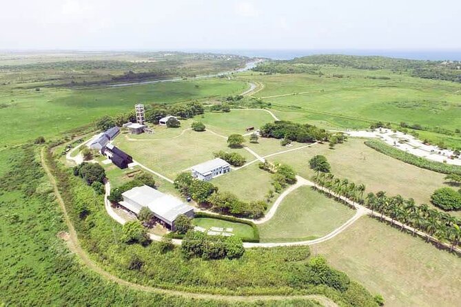
Next comes Manatí and a restored plantation that combines Puerto Rico’s colonial past with coastal scenery and protected wildlife. The suggested time is another four hours. This should appeal to you if you want more than natural swimming spots and would like a place where the island’s past and ecology share the same visit.
The word plantation can cover a wide range of experiences, so keep expectations measured. The available information confirms restoration, tours, history, coastal surroundings, and protected wildlife, but it does not provide detailed schedules or a full list of exhibits. Use the map’s preparation notes and direct link to confirm opening details before committing half a day.
The final stop on day two is Barceloneta, where the focus turns to outlet shopping and brand-name deals. The suggested duration is five hours, which makes this more than a short stop for souvenirs. It can work well if one person in your group wants retail time while others need a break from beaches and caves.
This is also where the route becomes less like a single scenic drive and more like a set of northern Puerto Rico options. Shopping may not fit your idea of a nature trip, but it gives families and mixed-interest groups some needed variety. You can also shorten this stop and use the saved time elsewhere, since the map is self-guided rather than a fixed tour.
Day three: sea caves, petroglyphs, and calm water
The third day is the busiest and most nature-focused section. It includes five stops around Manatí and Arecibo, with suggested visits ranging from four to five hours each. Taken literally, that is too much for one ordinary day once driving and meals are included, so treat the schedule as a menu of options rather than a race.
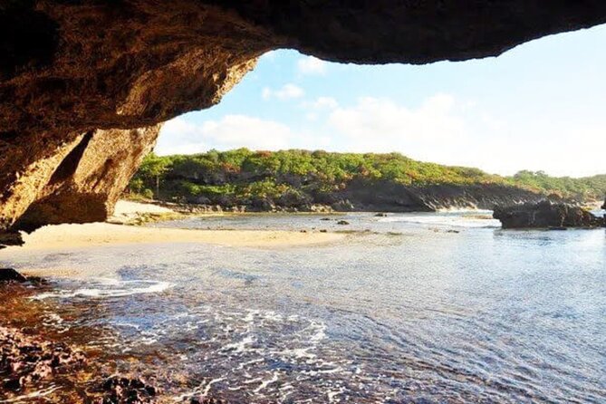
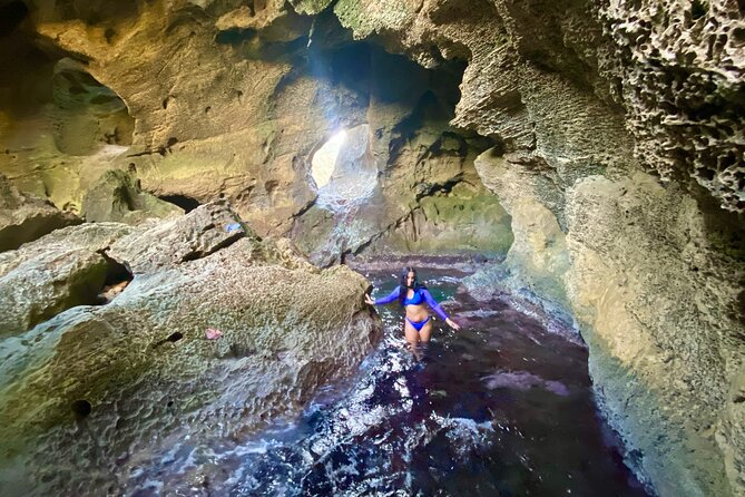
The first stop is Manatí’s Swallow Cave, a sea cave set in rocky cliffs where the cave opens toward the ocean. Swallows, waves, rock, and open sky create the kind of dramatic setting that makes this route feel different from a standard beach outing.
The five-hour estimate suggests you should leave room for the full outing, not simply arrive, snap a photo, and move on. Wear practical footwear and follow local conditions. The supplied details do not confirm facilities, lifeguards, or a particular access method, so you should not assume this is a simple, supervised swimming beach.
In Arecibo, the coastal cliffs and caves bring a human story into the natural setting. Ancient petroglyphs made by Puerto Rico’s first inhabitants are part of the visit, with waves crashing nearby. This is one of the most meaningful stops on the map because you are not only looking at rock formations. You are seeing evidence of people who lived on the island long before modern tourism.
Treat petroglyph sites with care. Do not touch, climb on, or mark carved surfaces. The available details do not specify an admission system or guided interpretation, so use the map’s notes and follow signs at the location.
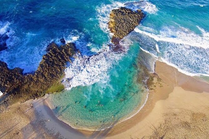
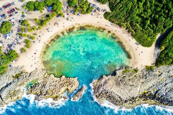
The next Manatí stop is a small horseshoe-shaped cove protected by rock formations. Its calm, shallow water is described as family-friendly, making it a good choice for a relaxed swim or float. If you have children, this is likely one of the most appealing locations on the route, though calm conditions can never be assumed at an open coastal site.
The attraction here is simple. You get a compact beach with natural shelter rather than a large resort setting. Bring what you need for a few hours, since the information provided does not promise food stands, restrooms, chairs, or shade.
Arecibo’s natural ocean pool offers a different kind of water experience. Waves crash around the surrounding rocks, while the swimming area remains calmer. That contrast gives the stop its appeal, but it also makes safety the main issue.
Only enter if conditions are clearly safe. Waves that look manageable from a distance can hit rock with force, and the pool may change with the tide or swell. The schedule allows five hours, but you do not need to stay that long if the ocean is rough. A shorter visit is a better choice than forcing a swim.
The last listed location is another Manatí swimming area with clear, calm rock pools protected from the larger waves outside. It is described as suitable for swimming and snorkeling, with the ocean breaking beyond the rock barriers.
This may be the easiest place to settle into a slow afternoon, but do not confuse calm water with guaranteed safety. Natural pools have uneven rock, changing water movement, and no confirmed lifeguard service in the supplied information. Bring suitable footwear and inspect the area before entering.
A few more options to weigh up in Puerto Rico
- San Juan Guided Snorkel With Turtles Tour and Videos
★ 5.0 · 12,947 reviews - Half-Day Yunque Rainforest Waterslide & rope swing Guided Tour
★ 5.0 · 6,534 reviews - Epic Guided Adventure in El Yunque National Rainforest & Beach
★ 4.5 · 456 reviews - El Yunque Rainforest Guided Day Tour from San Juan
★ 5.0 · 452 reviews
How to plan the three days without rushing
The published schedule gives you a useful structure, but it is ambitious. Day three alone lists up to 23 hours of suggested stop time. You should select the places that fit your interests instead of trying to complete every entry.
A practical approach is to group stops by mood:
- Choose Camuy for a cave-centered day.
- Pair Cataño and the plantation if you want rum, views, history, and a slower cultural pace.
- Use Barceloneta as a flexible shopping stop.
- Select two or three coastal sites in Manatí and Arecibo for swimming, sea caves, cliffs, or petroglyphs.
You may prefer to spend one full day on water sites and reserve another for Camuy and the cultural stops. The map is available for lifetime use, so you do not need to treat every destination as part of one three-day sprint.
The start and end point is listed at CGP9+6XG in Manatí, with operating hours from 7:00 AM to 6:00 PM daily during the stated period. Since this is not a vehicle pickup or a staffed meeting service, think of that point as the route’s reference location rather than a traditional tour departure.
Safety, weather, and what to carry
The most important advice concerns rivers. Check the forecast before you go, and visit only when the area is fully sunny with no chance of rain. Rivers can rise quickly after rain, and strong currents may develop even when conditions look acceptable at your starting point.
The same cautious attitude makes sense at ocean pools and sea caves. The map points you to places where water is part of the attraction, but nature does not follow a timetable. If waves are heavy, skies are cloudy, or access looks unsafe, skip the water.
You should also plan for the practical basics:
- Rental car with enough fuel for a spread-out route
- Money or a payment method for possible parking and entrance charges
- Water and meals, since food is not included
- Sturdy footwear for caves, cliffs, and rock pools
- Any personal swimming or snorkeling gear you want to use
- Sun protection for exposed coastal stops
- A phone with the PDF saved and Google Maps available
The moderate fitness recommendation is worth taking seriously. Several stops involve caves, cliffs, rocky ground, or water access. The exact difficulty is not provided, so you should judge each location for yourself and avoid assuming that a scenic place will be easy to reach.
Who gets the most from this self-guided format
I would choose this for someone who already plans to rent a car and enjoys making decisions on the road. Couples can pick a few scenic stops without paying for a private guide. Families can adjust the route around swimming conditions and energy levels. Solo visitors who dislike spending hours searching for ideas may also find the map useful.
It works less well if you want door-to-door transport, a guide explaining every location, or a tightly timed group excursion. You also need to be comfortable handling navigation, weather decisions, parking, and changes in plan.
The English PDF is a clear limitation for anyone who does not read English comfortably. The experience is also non-refundable and cannot be changed after booking, so buy it only when you are confident you want a self-drive plan.
Is this $5 Puerto Rico map worth buying?
For the price, I think it is a sensible planning tool, especially when several people share one purchase. The best features are practical rather than flashy: photos help you recognize places, local tips help you prepare, and direct Google Maps links reduce the usual navigation fuss.
I would not buy it expecting a full tour. You do not get transportation, a personal guide, meals, safety equipment, or guaranteed admission. The route also covers a wide area and includes enough suggested time to make the three-day plan feel crowded.
Buy it if you want a flexible list of north coast stops and you are happy to drive yourself. Skip it if you need a structured schedule, inclusive transport, or detailed on-site interpretation. For independent visitors who value freedom and want caves, coastal water, petroglyphs, rum, and shopping in one plan, $5 is a small gamble with useful upside.
FAQ
How much does the self-guided tour cost?
It costs $5 per group, for up to 12 people.
How long does the experience take?
The suggested duration is approximately three days. You choose how many stops to visit and how long to stay at each one.
Is transportation included?
No. You need to arrange your own transportation, and the experience is designed for self-driving with a rental car.
What does the digital map include?
You receive lifetime access to an English PDF with photos, local tips, exclusive recommendations, and direct Google Maps navigation links.
Are entrance fees included?
No. Most places are described as free, but some sites or parking areas may charge.
Are fuel, tolls, and parking included?
No. You pay for fuel, tolls, and parking separately.
Is equipment provided for cave or river visits?
No. Equipment such as helmets and life jackets is not provided.
What should you know before visiting rivers?
Check the weather first and go only when conditions are fully sunny with no chance of rain. Avoid rivers on cloudy days or when rain is forecast because water levels and currents can rise quickly.
Where does the activity start and end?
The listed start and end point is CGP9+6XG, Manatí, Puerto Rico. The stated hours are Monday through Sunday, 7:00 AM to 6:00 PM.
Just added in Puerto Rico
- Clear Bottom Kayaking and Snorkel Reef Exploration★ 5.0 · 1 review
- CLEAR BOTTOM KAYAKS Tour in Bioluminescent, Mosquito Bay★ 4.0 · 30 reviews
- Full Clear Kayak Bioluminescent Experience Vieques, Puerto Rico★ 5.0 · 1 review
- Isla de Vieques Beach Hopper Sightseeing Tour★ 3.0 · 2 reviews
- eFoil Lesson Old San Juan★ 5.0 · 5 reviews
- Private Tour of the White Canyon Ancestral Route in Utuado★ 5.0 · 7 reviews
- El Yunque Rainforest Party Tour with Waterslide and Rope Swinging★ 5.0 · 1 review
- Yoga and Sound Healing at the Beach!★ 5.0 · 1 review
Self-Guided Tours, compared.
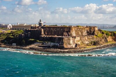

Talking Buildings of Old San Juan: A Self-Guided Audio Tour
Read our review →
The Ultimate Self-Guided Hidden Gems Tour in Puerto Rico
Read our review →

Browse the lists this tour appears in